-
About Union
Geographical & Economic
Miscellaneous
-
Union Parishad
Union Parishad
Union council activities
Village court
Important Info.
সেবা সমূহ
-
Government office
Union Agriculture Office
Union Land Office
Union Health Office
Union Social Service Office
-
Other Institutions
List of educational institutions
Non-governmental organizations
Religious institutions
Organizations
-
Different Lists
List of Beneficiarie s
Other listings
-
Projects
-
Services
Union Digital Center (UDC)
National E- Service
-
Gallery
Pictures
Video gallery
মেনু নির্বাচন করুন
-
About Union
Geographical & Economic
Miscellaneous
-
Union Parishad
Union Parishad
Union council activities
Village court
Important Info.
সেবা সমূহ
-
Government office
Union Agriculture Office
Union Land Office
Union Health Office
Union Social Service Office
Union Ansar Office
-
Other Institutions
List of educational institutions
Non-governmental organizations
Religious institutions
Organizations
-
Different Lists
List of Beneficiarie s
Other listings
-
Projects
-
Services
Union Digital Center (UDC)
National E- Service
-
Gallery
Pictures
Video gallery
Main Comtent Skiped
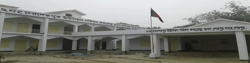
Charsherpur Union at a glance
Charsherpur Union at a glance
Union Introduction: This union is located at Charsherpur village on the left side of Char LGD Paka Road in Jamalpur Bastant Haet Baman along the highway from Sadar upazila of Sherpur district. Mr. It is bounded on the east by Sherpur Municipality, on the north by Kharia Kazir Char UP, on the south by Charmocharia UP, and on the west by Kamar Char. The river Mrigi flows through the northern part of the Union.Information of Charsherpur Union No. 2 at a glance
1. Name of Union Parishad: Charsherpur Union No. 72
2. Union area: 18.60 sq. Km. M about
3. Number of wards in the union: 9
4.7 Number of villages in the union: 29
5. Population of the Union: About 33314 people (according to 2001 census)
. Freedom fighters: 20 people
. Expatriates: 218 people
. Doctor: 1 person
9. Total amount of land: about 755.51 acres
10. Amount of cultivable land: 5148.96 acres approx11. Amount of uncultivated land: Approximately 49.12 acres
12. Amount of khas land: 181.36 acres approx
13. Government primary schools: 14
14. Reg: Primary school: 4
15. High school: 2
16. Madrasa: 4
16. Polytechnic Institute: 1
16. There is no rural electricity committee
19. Youth Development Office: No.
20 Public health center: 1
21. Blind school: No
22. Filling station: No.
23. Community Clinics: 5
24. Family Planning Office: 1
25. Number of hat bazaars: 4
26. Number of mosques: 5126. Cemeteries: 5
26. Eidgah field: 25
29. Shrines: 3
30 NGO: 1
31. Number of students with disabilities: 5
32. Number of widow allowance recipients: 210
33. Number of adult allowance recipients: 601
34. Number of disabled beneficiaries: 63
35. Number of VGD beneficiaries: 159
36. Number of VGF allowance recipients: 26
36. Number of poor beneficiaries: 202

Site was last updated:
2024-02-14 19:16:50
Planning and Implementation: Cabinet Division, A2I, BCC, DoICT and BASIS
Technical Assistance:
![]()
Developed By: